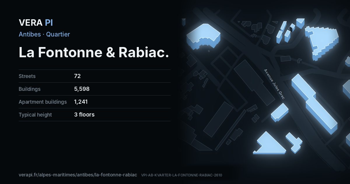
About La Fontonne & Rabiac
North of the station, Antibes is an everyday town of neighbourhood shops, schools and apartment blocks. VERA PI groups five of INSEE’s districts here – La Fontonne, Rabiac-La Paganne, Les Prugnons, Azurville-Val Claret and La Constance-Le Puy – between the railway and the hills.
Text: Metro Mode. Sources: INSEE / IGN – Contours IRIS; Wikipédia – Antibes (Quartiers).
La Fontonne & Rabiac on the map
What to see in La Fontonne & Rabiac
Anthéa – Antipolis Théâtre d’Antibesanthéa – Antipolis Théâtre d’Antibes – is the town’s large modern performance hall, on the Avenue Jules-Grec, with its programme published season by season.Antibes observatoryBuilding · La Fontonne & RabiacMonument aux morts du Souvenir Français d'AntibesMonument · La Fontonne & Rabiac Jean Bunoz Sports HallBuilding · La Fontonne & RabiacFlorent06 · CC BY-SA 3.0 · Wikimedia CommonsÉglise Notre-Dame-de-l'Assomption d'AntibesChurch · Saint-Jean & Fontmerle
 Église Saint-Joseph d'AzurvilleChurch · La Fontonne & RabiacOriginal uploader was Aimelaime at fr.wikipedia · Public domain · Wikimedia Commons
 Chapelle Notre-Dame-de-Lumière d'AntibesChurch · La Fontonne & RabiacAbxbay · CC BY-SA 4.0 · Wikimedia CommonsAvenue de NiceBuilding · La Fontonne & RabiacParc des sports Docteur LégerPark · La Fontonne & Rabiac
Jean Bunoz Sports HallBuilding · La Fontonne & RabiacFlorent06 · CC BY-SA 3.0 · Wikimedia CommonsÉglise Notre-Dame-de-l'Assomption d'AntibesChurch · Saint-Jean & FontmerleÉglise Saint-Joseph d'AzurvilleChurch · La Fontonne & RabiacOriginal uploader was Aimelaime at fr.wikipedia · Public domain · Wikimedia CommonsChapelle Notre-Dame-de-Lumière d'AntibesChurch · La Fontonne & RabiacAbxbay · CC BY-SA 4.0 · Wikimedia CommonsAvenue de NiceBuilding · La Fontonne & RabiacParc des sports Docteur LégerPark · La Fontonne & RabiacPlaces
Sights
- Anthéa – Antipolis Théâtre d’AntibesTheatre · Avenue Jules Grec
- Antibes observatoryBuilding · Chemin de l'Orangerie
- Avenue de NiceBuilding · Avenue de l'Aqueduc Romain
- Chapelle Notre-Dame-de-Lumière d'AntibesChurch · Avenue de Nice
- Jean Bunoz Sports HallBuilding · Rue Line Renaud-Loulou Gasté
- Monument aux morts du Souvenir Français d'AntibesMonument · Avenue Philippe Rochat
- Parc des sports Docteur LégerPark · Boulevard du Beau Rivage
- Église Notre-Dame-de-l'Assomption d'AntibesChurch · Avenue Philippe Rochat
- Église Saint-Joseph d'AzurvilleChurch · Place Jean Aude
Eat & drink
- 6T9Fast food · Chemin des Frères Garbero
- Au Bruit Qui CourtRestaurant · Avenue Jules Grec
- Aux 2 CuissesRestaurant · Avenue de Nice
- Bar Les TilleulsFast food · Avenue Jules Grec
- Bistro TeatroRestaurant · Avenue Jules Grec
- Café LoretteRestaurant · Avenue de Nice
- Cosmo SushiRestaurant · Avenue Philippe Rochat
- Delyse FoodFast food · Chemin des Frères Garbero
- India WalaRestaurant · Boulevard du Beau Rivage
- L'AromateRestaurant · Avenue Philippe Rochat
- La BièrerieRestaurant · Chemin des Frères Garbero
- La grignotteFast food · Avenue Jules Grec
- La LucarneRestaurant · Avenue Jules Grec
- Maison MaillardRestaurant · Place Jean Aude
- Menthe Et BalicoRestaurant · Chemin des Frères Garbero
- Mister PizzaFast food · Avenue Jules Grec
- Panetti Pizza ClubFast food · Avenue Philippe Rochat
- Pizz'AielloRestaurant · Avenue Jules Grec
- Pizza by MorissetFast food · Avenue Philippe Rochat
- Pizza KellyFast food · Avenue de Nice
- Restaurant Le CollierRestaurant · Boulevard Général Vautrin
- Stop PizzaFast food · Avenue de Nice
- Turkish KebabFast food · Chemin des Frères Garbero
Hotels
Shops
- AD Garage L'Atelier Aux Ouvriers RéunisCar repair · Avenue Philippe Rochat
- Allard FleursFlorist · Avenue Philippe Rochat
- Alpha PressingLaundry · Avenue Jules Grec
- Art DecoFlorist · Chemin de Beauvert
- AuchanGas · Avenue Philippe Rochat
- Auchan SupermarchéSupermarket · Avenue Philippe Rochat
- Auto Meca LogisticCar repair · Avenue de Nice
- B. HappyBakery · Avenue Jules Grec
- BalitrandTrade · Avenue Jules Grec
- BonoBakery · Avenue de Nice
- Boucherie De La FontonneButcher · Chemin des Frères Garbero
- Boucherie MaherConvenience · Chemin des Frères Garbero
- Boulangerie RochatBakery · Avenue Philippe Rochat
- Carosserie CarclinicCar repair · Chemin de Beauvert
- Carrosserie de la BragueCar repair · Boulevard Beau Rivage Prolongé
- Carrosserie De La FontonneCar repair · Rond-Point Beau Rivage
- Carrosserie Mechanique des BreguieresCar repair · Chemin des Basses Bréguières
- Ciffréo BonaHardware · Avenue Philippe Rochat
- Clément CottardBakery · Chemin des Frères Garbero
- Coopérative Agricole d'AntibesGarden centre · Avenue Jules Grec
- Couleurs de Tollens AntibesPaint · Avenue Philippe Rochat
- Cycles AntipolisBicycle · Avenue Philippe Rochat
- D'un monde à l'autreFuneral directors · Avenue Philippe Rochat
- Dynamic OrthopédieMedical supply · Avenue Jules Grec
- Ets Gassier Et FilsSupermarket · Avenue Philippe Rochat
- Garage CarrerCar · Boulevard Beau Rivage Prolongé
- Hair Line CoiffureHairdresser · Avenue Jules Grec
- HondaCar · Avenue de Nice
- Jacques RibetBakery · Avenue Philippe Rochat
- Jean MalizardSeafood · Place Jean Aude
- L'éléganceHairdresser · Centre Commercial de la Fontonne
- La Coupe Trad'Butcher · Avenue Philippe Rochat
- Laundry Service La FontonneLaundry · Avenue de Nice
- Laverie RochatLaundry · Boulevard Général Vautrin
- Le Barbier d'AntibesHairdresser · Avenue Philippe Rochat
- Le Cercle De La VapE-cigarette · Avenue Jules Grec
- Le Jardin de JoséphineConvenience · Avenue de Nice
- Le Moulin de ProvenceBakery · Place Jean Aude
- Le SalonHairdresser · Avenue Jules Grec
- Les Producteurs du RocherGreengrocer · Avenue de Nice
- Les Roses d'AntibesGreengrocer · Chemin de la Constance
- Lolita coiffureHairdresser · Avenue Jules Grec
- Maison MaillardButcher · Place Jean Aude
- Maison Saint-JalmeBakery · Avenue de Nice
- Marché BeauvertFarm · Chemin de Beauvert
- MD Coiff'Hairdresser · Avenue Jules Grec
- Moscow MarketSupermarket · Avenue Philippe Rochat
- OpelCar repair · Avenue Philippe Rochat
- PFG Services funérairesFuneral directors · Avenue de Nice
- PH06Car · Boulevard Beau Rivage Prolongé
- PicardFrozen food · Avenue Philippe Rochat
- Pompes Funèbres AntiboisesFuneral directors · Place Jean Aude
- Pressing De L'EsterelLaundry · Avenue Philippe Rochat
- Pro Shop MotoMotorcycle · Avenue Philippe Rochat
- Ritual NailsBeauty · Avenue Philippe Rochat
- Riviera TabacTobacco · Place Jean Aude
- Roc-EclercFuneral directors · Avenue de Nice
- Salica AnconettiHardware · Avenue Philippe Rochat
- SparConvenience · Avenue de Nice
- Style D'intérieurInterior decoration · Avenue de Nice
- Surgelés d'AntibesFrozen food · Boulevard du Beau Rivage
- Tabac PresseNewsagent · Avenue Jules Grec
- TotalConvenience;gas · Avenue de Nice
- VivalConvenience · Avenue de Nice
- Vival by CasinoConvenience · Avenue Jules Grec
Every street in La Fontonne & Rabiac – 72 street guides
- Allée Jean de la Fontaine
- Allée des Cigales
- Allée des Grillons
- Allée des Phalènes
- Avenue Jean Mermoz
- Avenue Jules Grec
- Avenue Lamartine
- Avenue Philippe Rochat
- Avenue de Nice
- Avenue de l'Aqueduc Romain
- Avenue de la Fontonne
- Avenue de la Paganette
- Avenue de la Pépinière
- Avenue de la Verte Pagane
- Avenue des Observatoires
- Avenue du Château de l'Espée
- Avenue du Mas Ensoleillé
- Avenue Émilie
- Boulevard Beau Rivage Prolongé
- Boulevard Général Vautrin
- Boulevard du Beau Rivage
- Boulevard du Val Claret
- Centre Commercial de la Fontonne
- Chemin Alexis Dalmasso
- Chemin Marius et François Spagnon
- Chemin de Beauvert
- Chemin de l'Orangerie
- Chemin de la Constance
- Chemin de la Parouquine
- Chemin de la Suquette
- Chemin des Arums
- Chemin des Basses Bréguières
- Chemin des Frères Garbero
- Chemin des Maures
- Chemin des Oliviers
- Chemin des Quatre Chemins
- Chemin du Petit Four
- Chemin du Prugnon
- Chemin du Puy
- Cours de la Liberté
- Domaine des Rastines
- Impasse Beauvert
- Impasse Fleurie
- Impasse Numéro 12
- Impasse de la Brague
- Impasse des Aloès
- Impasse des Arums
- Impasse des Tilleuls
- Impasse du Jardin des Roses
- Impasse du Panorama de la Constance
- Impasse du Soleil Levant
- Impasse du Val Claret
- Les Demeures du Soleil
- Les Tilleuls
- Parc des Orangers
- Parc des Rastines
- Place Jean Aude
- Rond-Point Beau Rivage
- Rond-Point de Beauvert
- Rond-Point des Quatre Chemins
- Rond-Point des Rastines
- Rond-Point des Tilleuls
- Rond-Point du Lycée Jacques Dolle
- Rond-Point du Val Claret
- Rue Bicon
- Rue Claude Debussy
- Rue Gairaud
- Rue Line Renaud-Loulou Gasté
- Rue de l'Église
- Résidence Las Palmas
- Traverse de l'Aqueduc
- Villa Sonia
Sources
Quartier: INSEE’s IRIS districts (IGN CONTOURS-IRIS, Licence Ouverte 2.0), grouped by VERA PI. Buildings, streets and places: © OpenStreetMap contributors, ODbL 1.0, and VERA PI’s own register. Sights: Wikidata (CC0) and the Mérimée base; photographs from Wikimedia Commons under the licence shown on each. Text: Metro Mode, with its sources above.