Walk the street
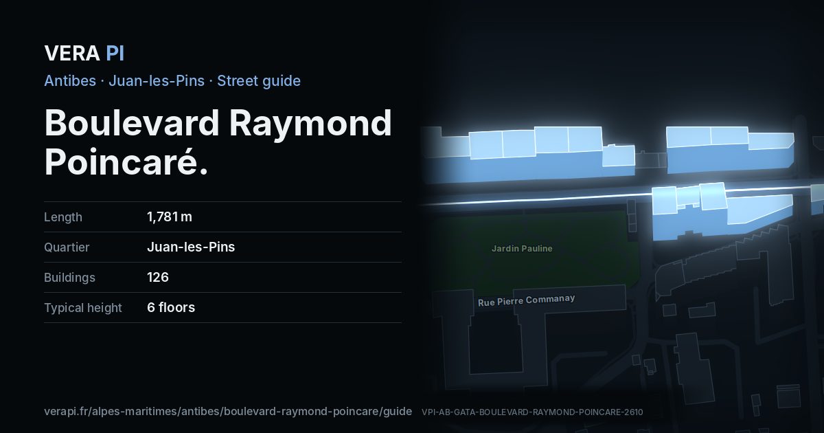
Every apartment building and landmark on Boulevard Raymond Poincaré, drawn at its height from OpenStreetMap. Walk it with the slider, switch sides, or tap a building for its card.
Skip the mapEverything along the street
Building by building
126 buildings with their own page on Boulevard Raymond Poincaré. Tap one to see it on the map.
Odd numbers 41
- 9Apartment buildingbuilt 1931 · 2 floors
- 9Apartment buildingbuilt 1931 · 2 floors
- 11Apartment buildingbuilt 2000 · 8 floors
- 13Apartment buildingbuilt 1958 · 7 floors
- 15-21Apartment buildingbuilt 1966 · 8 floors
- 27Public building3 floors
- 27Public building4 floors
- 47Le Baltimorebuilt 1974 · 8 floors
- 49Apartment buildingbuilt 1990 · 7 floors
- 49Apartment buildingbuilt 1990 · 7 floors
- 53Apartment buildingbuilt 2006 · 8 floors
- 55Apartment buildingbuilt 1992 · 8 floors
- 57Apartment buildingbuilt 1959 · 3 floors
- 57Apartment buildingbuilt 1959 · 3 floors
- 59Apartment buildingbuilt 1964 · 2 floors
- 59Apartment buildingbuilt 1964 · 2 floors
- 61Apartment buildingbuilt 1996 · 8 floors
- 63Apartment buildingbuilt 1965 · 8 floors
- 65Apartment building6 floors
- 71Apartment buildingbuilt 2020 · 8 floors
- 73Apartment buildingbuilt 1993 · 8 floors
- 75Apartment building8 floors
- 79Apartment buildingbuilt 1976 · 8 floors
- 77Apartment buildingbuilt 1970 · 8 floors
- 79Apartment buildingbuilt 1965 · 8 floors
- 83Apartment buildingbuilt 1985 · 8 floors
- 87Apartment buildingbuilt 1977 · 8 floors
- 89-93Apartment buildingbuilt 2002 · 8 floors
- 93Apartment buildingbuilt 2002 · 8 floors
- 93Apartment buildingbuilt 2002 · 8 floors
- 105Apartment buildingbuilt 1930 · 3 floors
- 107Apartment buildingbuilt 2018 · 8 floors
- 105Apartment buildingbuilt 1930 · 3 floors
- 109Apartment buildingbuilt 1964 · 8 floors
- 109Apartment buildingbuilt 1964 · 8 floors
- 113Apartment buildingbuilt 1928 · 3 floors
- 113Apartment buildingbuilt 1928 · 3 floors
- 117Apartment buildingbuilt 1963 · 3 floors
- 117Apartment buildingbuilt 1963 · 3 floors
- 117Apartment buildingbuilt 1963 · 3 floors
- 121Apartment buildingbuilt 2007 · 7 floors
Even numbers 85
- 6Apartment building3 floors
- 12Apartment buildingbuilt 1930 · 2 floors
- 12Apartment buildingbuilt 1930 · 2 floors
- 12Apartment buildingbuilt 1930 · 2 floors
- 16bisApartment buildingbuilt 1911 · 2 floors
- 12Apartment buildingbuilt 1930 · 2 floors
- 16bisApartment buildingbuilt 1911 · 2 floors
- 18Apartment buildingbuilt 1909 · 2 floors
- 22Apartment buildingbuilt 1930 · 2 floors
- 26 bisApartment buildingbuilt 1930 · 6 floors
- 26Apartment building2 floors
- 22Apartment buildingbuilt 1930 · 2 floors
- 18Apartment buildingbuilt 1909 · 2 floors
- 26Apartment building2 floors
- 22Apartment buildingbuilt 1930 · 2 floors
- 22Apartment buildingbuilt 1930 · 2 floors
- 22Apartment buildingbuilt 1930 · 2 floors
- 22Apartment buildingbuilt 1930 · 2 floors
- 32Apartment building2 floors
- 22Apartment buildingbuilt 1930 · 2 floors
- 32Apartment building2 floors
- 28Apartment buildingbuilt 1930 · 6 floors
- 30bisApartment buildingbuilt 1920 · 3 floors
- 30bisApartment buildingbuilt 1920 · 3 floors
- 30bisApartment buildingbuilt 1920 · 3 floors
- 30bisApartment buildingbuilt 1920 · 3 floors
- 30bisApartment buildingbuilt 1920 · 3 floors
- 32Apartment building2 floors
- 34Apartment buildingbuilt 1965 · 6 floors
- 34Apartment buildingbuilt 1965 · 6 floors
- 40Apartment buildingbuilt 1923 · 1 floors
- 40Apartment buildingbuilt 1923 · 1 floors
- 52-54 terApartment buildingbuilt 1965 · 4 floors
- 54Apartment buildingbuilt 1956 · 2 floors
- 58Apartment buildingbuilt 1970 · 7 floors
- 60Apartment buildingbuilt 2023 · 8 floors
- 60Apartment buildingbuilt 2023 · 8 floors
- 60Apartment buildingbuilt 2023 · 8 floors
- 62Apartment buildingbuilt 2023 · 8 floors
- 64Apartment buildingbuilt 1980 · 3 floors
- 64Apartment buildingbuilt 1980 · 3 floors
- 66Apartment buildingbuilt 1956 · 3 floors
- 66Apartment buildingbuilt 1956 · 3 floors
- 68 bis-72Apartment buildingbuilt 1992 · 7 floors
- 74Apartment buildingbuilt 1934 · 5 floors
- 78Apartment buildingbuilt 1967 · 8 floors
- 78Apartment buildingbuilt 1967 · 8 floors
- 78Apartment buildingbuilt 1967 · 7 floors
- 78Apartment buildingbuilt 1967 · 8 floors
- 82-86Le Silvaplanabuilt 2002 · 8 floors
- 88Le Juanabuilt 1999 · 8 floors
- 90Apartment buildingbuilt 1960 · 8 floors
- 90-92 bisLes Sirenesbuilt 1960 · 8 floors
- ·Apartment building8 floors
- 98Apartment buildingbuilt 1967 · 8 floors
- 100Apartment buildingbuilt 1988 · 8 floors
- 100Apartment buildingbuilt 1988 · 8 floors
- 100Apartment buildingbuilt 1988 · 8 floors
- 102Apartment buildingbuilt 2002 · 8 floors
- 104Apartment buildingbuilt 2000 · 3 floors
- 108Apartment buildingbuilt 1938 · 4 floors
- 110Apartment building3 floors
- 114-116Apartment buildingbuilt 1976 · 8 floors
- 116 bisApartment buildingbuilt 1972 · 9 floors
- 118Apartment buildingbuilt 1972 · 9 floors
- 120Apartment buildingbuilt 1972 · 8 floors
- 128-130Apartment buildingbuilt 1986 · 7 floors
- 132Apartment building5 floors
- 132Apartment building5 floors
- 132Apartment building5 floors
- 132Apartment buildingbuilt 1923 · 2 floors
- 132Apartment building5 floors
- 132Apartment building5 floors
- 132Apartment building5 floors
- 132Apartment building5 floors
- 138Apartment buildingbuilt 1933 · 2 floors
- 144Apartment buildingbuilt 2010 · 7 floors
- 144Apartment buildingbuilt 2010 · 7 floors
- 144Apartment buildingbuilt 2010 · 7 floors
- 144Apartment buildingbuilt 2010 · 7 floors
- 146Apartment buildingbuilt 2010 · 7 floors
- 144Apartment buildingbuilt 2010 · 7 floors
- 144Apartment buildingbuilt 2010 · 7 floors
- 150Apartment buildingbuilt 2002 · 10 floors
- 156Apartment building8 floors
Notable buildings and places
Getting around
- BusSquare Dulys
- BusJardin Pauline
- BusSquare Dulys
- BusTrianon
- BusPasserelle SNCF Juan-les-Pins
- BusRégence
Stops within 250 m of the street. Compagnie des Autobus d’Antibes, timetable valid 5 October – 18 December 2026 (Licence Ouverte 2.0).
Schools nearby
- ·École maternelle PeynetSchool
- ·École primaire Guillaume MussoSchool
- ·École primaire Pont DulysSchool
- ·Lycée AudibertiSchool
Within 400 m; OpenStreetMap.
Streets that meet it
Boulevard Gustave Chancel Rue Pauline Avenue de Cannes Chemin des Liserons Route de la Badine Rue Pierre Loti Chemin des Îles Rue Flore Chemin de la Colle Avenue Vilmorin Chemin Fournel Badine Avenue du Grand Pin Avenue Amiral Courbet Rue Saint-Honorat Boulevard des Nations Rue Sainte-Marguerite Rue des Îles Square Dulys Impasse du Trianon Impasse Sainte-Thérèse
Sources
- Buildings, heights, streets and places: © OpenStreetMap contributors, ODbL 1.0.
- Sights: Wikidata (CC0) and Wikipedia (CC BY-SA 4.0); photographs from Wikimedia Commons under the licence shown on each.
- Buses: Compagnie des Autobus d’Antibes GTFS, via transport.data.gouv.fr (Licence Ouverte 2.0).
- Sun: VERA PI’s model with the Copernicus GLO-30 terrain (© DLR e.V. 2010-2014 and © Airbus Defence and Space GmbH 2014-2018, provided under COPERNICUS by the European Union and ESA).
A VERA PI street guide – the same model as Strandvägen, Stockholm, fed with the open data of Antibes and France. Built 25 October 2026.