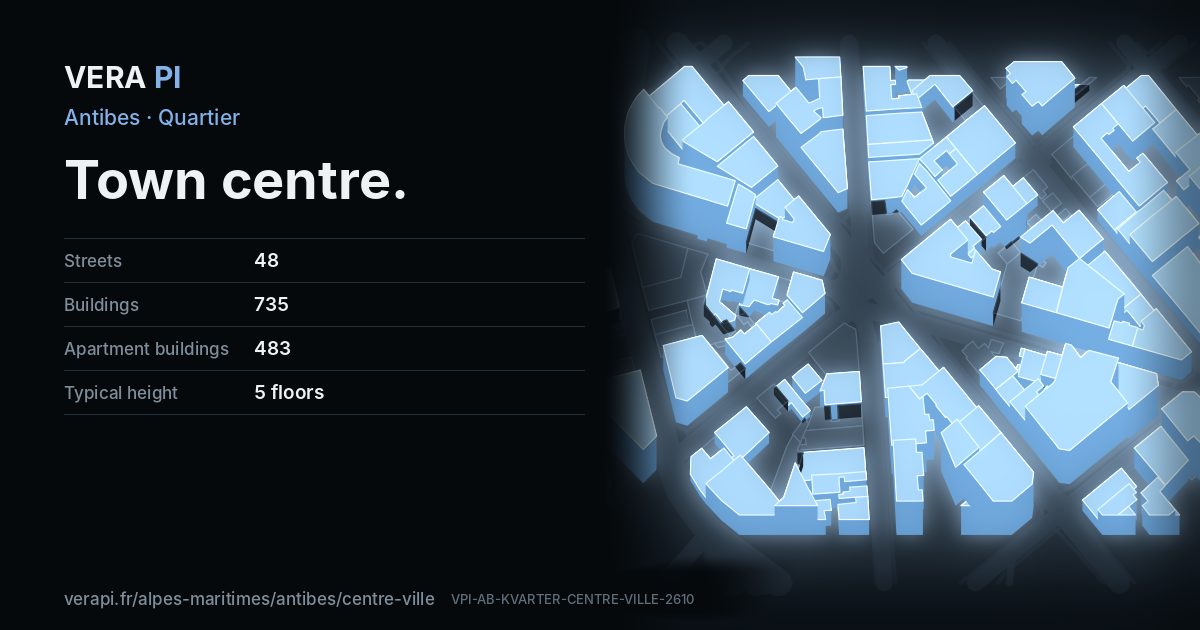
About Town centre
When the walls came down, Antibes spread inland. The Place Charles-de-Gaulle, with its Haussmann-style buildings, is the hinge between the old town and the new; the Boulevard Albert-Ier runs from it to the sea, past the Square Élie-Lévy where the town plays pétanque. Up the Rue de la République, remains of the Porte de France survive in front of the pharmacy.
The shopping streets – the Rue de la République, the Rue Sade, the Rue James-Close – lead back towards the old town. The Place de Gaulle has a morning market on Tuesdays, Thursdays and Saturdays, and the Boulevard Albert-Ier one on Thursdays.
Text: Metro Mode. Sources: Office de Tourisme – Antibes, la cité des remparts; Office de Tourisme – Antibes step by step; Office de Tourisme – The markets.
Town centre on the map
What to see in Town centre
 Bastion Saint-AndréPalace · Vieil AntibesAimelaime · CC BY-SA 3.0 · Wikimedia Commons
 Église du Sacré-Cœur d'AntibesChurch · Town centreAbxbay · CC0 · Wikimedia Commons
 Place du Général-de-GaulleBuilding · Town centreAlkhimov Maxim · CC BY 3.0 · Wikimedia Commons
 Temple protestant d'AntibesBuilding · Town centreAimelaime at French Wikipedia · Public domain · Wikimedia Commons
Places
Sights
- Bastion Saint-AndréPalace · Avenue Barquier
- La Petite AcadémieArts centre · Avenue du 24 Août
- Le CasinoCinema · Avenue du 24 Août
- Monument romain provenant de BiotMonument · Avenue Général Maizière
- Place du Général-de-GaulleBuilding · Place du Général de Gaulle
- Temple protestant d'AntibesBuilding · Boulevard Albert 1er
- Église du Sacré-Cœur d'AntibesChurch · Rue Directeur Chaudon
Eat & drink
- Alto PizzaFast food · Avenue Général Maizière
- Antibes GrillRestaurant · Rue Directeur Chaudon
- Au CaféCafé · Avenue Robert Soleau
- Bar ApopoBar · Boulevard Albert 1er
- Bar Café Porte de FranceCafé · Boulevard Gustave Chancel
- Boulangerie de la GareCafé · Avenue Robert Soleau
- Bouquet de FruitsFast food · Avenue Robert Soleau
- Café KanterRestaurant · Boulevard Albert 1er
- Chez MôRestaurant · Boulevard Albert 1er
- Coffee NookCafé · Rue Sadi Carnot
- Diwan Al BachaRestaurant · Avenue Tourre
- Domino'sFast food · Avenue du 24 Août
- Fleur de CaféCafé · Avenue du 24 Août
- Gelateria l'Albert 1erIce cream · Boulevard Albert 1er
- Golden BeefRestaurant · Avenue Général Maizière
- Hong YunRestaurant · Avenue Tournelli
- India SnackFast food · Avenue Gazan
- Indian FoodRestaurant · Boulevard du Maréchal Foch
- K-barréBar · Avenue Niquet
- KaakoFast food · Boulevard du Maréchal Foch
- L'instant CaféCafé · Boulevard Albert 1er
- La BrasserieRestaurant · Avenue Robert Soleau
- La Civette de l'EtoileCafé · Avenue Robert Soleau
- La Cour des ThésRestaurant · Avenue du 24 Août
- La FamigliaRestaurant · Avenue Thiers
- La FattoriaFast food · Boulevard Albert 1er
- La placeRestaurant · Avenue du 24 Août
- La StoriaRestaurant · Boulevard Dugommier
- La TrattoriaRestaurant · Avenue Pasteur
- Le 44Restaurant · Boulevard Albert 1er
- Le 59Restaurant · Boulevard du Maréchal Foch
- Le Bon MatinRestaurant · Boulevard du Maréchal Foch
- Le PerkoCafé · Avenue Robert Soleau
- Le PheniciaRestaurant · Avenue Barquier
- Le PralinCafé · Boulevard Albert 1er
- Les Saveurs de DjerbaRestaurant · Boulevard Dugommier
- Little EstasiRestaurant · Avenue du 24 Août
- MakaoBar · Rue Vauban
- Miam MiamFast food · Rue Ernest Macé
- Mouss'CoffeeCafé · Boulevard Albert 1er
- Nki SushiRestaurant · Boulevard Gustave Chancel
- O'TacosFast food · Boulevard Dugommier
- Pizza d'ElineRestaurant · Boulevard du Maréchal Foch
- PulcinellaRestaurant · Avenue Meissonnier
- Regal D'AsieRestaurant · Boulevard du Maréchal Foch
- Romagna MiaRestaurant · Avenue Maréchal Reille
- Ruby's GardenCafé · Rue Ernest Macé
- Square SudCafé · Place Général de Gaulle
- Sushi ShopRestaurant · Boulevard Dugommier
- Trib'sRestaurant · Avenue Robert Soleau
- Uta RamenRestaurant · Avenue des Frères Olivier
- Vert DéliceRestaurant · Avenue Thiers
Hotels
Shops
- AgemFurniture · Avenue du Grand Cavalier
- Agence des RempartsEstate agent · Avenue Pasteur
- Alain AfflelouOptician · Place Général de Gaulle
- ALBeautyBeauty · Avenue Guillabert
- AmplifonHearing aids · Boulevard Albert 1er
- AngelinaInterior decoration · Rue Ernest Macé
- Antibes InformatiqueComputer · Boulevard Gustave Chancel
- Antibes VoyagesTravel agency · Boulevard Albert 1er
- Arthur BonnetKitchen · Avenue Robert Soleau
- ArtichokeCraft · Avenue du 24 Août
- Asia FrèresSupermarket · Boulevard Gustave Chancel
- AtolOptician · Avenue Robert Soleau
- AudikaHearing aids · Boulevard Dugommier
- Audition ConseilHearing aids · Place Général de Gaulle
- Auto ProfitCar repair · Boulevard Gustave Chancel
- BanbijouClothes · Avenue Niquet
- Barber ShopHairdresser · Boulevard du Maréchal Foch
- Beauté ConfidentielBeauty · Avenue Gazan
- Bisboutique VintageClothes · Boulevard Gustave Chancel
- Boitures by M&SFlorist · Rue Vauban
- BonoboClothes · Boulevard du Président Wilson
- Boucherie FochButcher · Boulevard du Maréchal Foch
- Boucherie Palmier d'AntibesButcher · Boulevard du Maréchal Foch
- Boulevard Du PainBakery · Boulevard Gustave Chancel
- Brin de SoieTailor · Boulevard Albert 1er
- California TatooTattoo · Avenue Robert Soleau
- CaritaBeauty · Avenue Robert Soleau
- CarollClothes · Avenue Niquet
- Carrefour CityConvenience · Avenue Robert Soleau
- Carrefour MarketSupermarket · Avenue Pasteur
- CBD QueenCannabis · Boulevard du Maréchal Foch
- Chouchou LaverieLaundry · Rue des Lits Militaires
- Clé and GoLocksmith · Avenue Gambetta
- Coiffure Nirina R.Hairdresser · Avenue Principal Pastour
- Comptoir National de l'orGold buyer · Boulevard du Maréchal Foch
- Couleur CoutureClothes · Boulevard du Maréchal Foch
- D/HBeauty · Avenue Niquet
- Dernier rempartBooks · Avenue du 24 Août
- DessangeHairdresser · Rue Vauban
- DestockCarpet · Boulevard du Maréchal Foch
- DéesseHairdresser · Boulevard du Maréchal Foch
- E.I.CYes · Avenue Guillabert
- Eden Vert 3DAgrarian · Boulevard Dugommier
- El DarioButcher · Avenue Robert Soleau
- Electricite E'lyvioYes · Avenue Frédéric Mistral
- Elite CoiffureHairdresser · Avenue Gazan
- En ApartéHairdresser · Avenue Thiers
- Enjoy by SophieClothes · Avenue Guillabert
- EntreprendreHardware · Avenue du 24 Août
- Eroshop-Vidéo XErotic · Rue Vauban
- Esthétiquement votre...Beauty · Avenue Guillabert
- Exception AudioHifi · Avenue Général Maizière
- FarnienteFishing · Avenue Gazan
- Fournil des Frères OlivierBakery · Avenue des Frères Olivier
- France d'OrPawnbroker · Avenue Gazan
- France Pare-BriseCar repair · Rue des Lits Militaires
- Frank ProvostHairdresser · Avenue des Frères Olivier
- FrankiHairdresser · Boulevard Albert 1er
- Garage Auto AzurCar repair · Rue des Lits Militaires
- Garage Du PrintempsCar repair · Boulevard Gustave Chancel
- Georges Electricité BateauxElectrical · Rue Sadi Carnot
- Godot & FilsGold buyer · Place Général de Gaulle
- Golden Barber ShopHairdresser · Boulevard du Maréchal Foch
- Golden ShopGold buyer · Avenue Gazan
- GSM CliniqueMobile phone · Avenue Guillabert
- HerbolariumTea · Boulevard du Maréchal Foch
- Ibghi DécorationInterior decoration · Avenue Thiers
- Ilyes CoiffureHairdresser · Boulevard Gustave Chancel
- Indian SpicesConvenience · Parvis Simone Weil
- IntermarchéSupermarket · Boulevard du Président Wilson
- Janine RobinClothes · Place Général de Gaulle
- JFG ClinicBeauty · Avenue des Frères Olivier
- Joaillier Artisan d'ArtJewelry · Avenue Pasteur
- Johann StoresWindow blind · Rue Honoré Ferrare
- Just for menHairdresser · Avenue Thiers
- kimClothes · Boulevard Albert 1er
- KrysOptician · Place Général de Gaulle
- L'antiboise d'OptiqueOptician · Avenue du 24 Août
- L'atelier d'AnnaBeauty · Rue Vauban
- L'atelier vert tendreFlorist · Boulevard Albert 1er
- L'homme parfaitHairdresser · Boulevard du Maréchal Foch
- L'ImpeccableTailor · Avenue Guillabert
- L'Ongle LysBeauty · Avenue Guillabert
- L'opticienne VerteOptician · Rue Vauban
- L'uni-verre de JessicaOptician · Boulevard Albert 1er
- La Belle CoutureTailor · Avenue Gambetta
- La Bohème CoiffureHairdresser · Rue Directeur Chaudon
- La Bonne AdresseClothes · Avenue Gazan
- La Cave d'AntibesWine · Avenue Niquet
- La cave des épicuriensWine · Avenue Gazan
- La Galerie d'AntibesArt · Avenue Guillabert
- La MercerieSewing · Avenue Robert Soleau
- La Petite SellerieTapestry · Boulevard du Maréchal Foch
- La PrettyClothes · Avenue Général Maizière
- La SuiteClothes · Avenue des Frères Olivier
- La ToscanaTobacco · Boulevard Gustave Chancel
- La Vie ClaireSupermarket · Rue Sadi Carnot
- Laverie Pressing du CapLaundry · Avenue Général Maizière
- Le Milena By ClaireHairdresser · Boulevard Albert 1er
- Le Petit VapoteurE-cigarette · Avenue des Frères Olivier
- Leader Clean PressingDry cleaning · Avenue Niquet
- Lentilles de ContactOptician · Boulevard du Maréchal Foch
- Les Maîtres du Bain Par DalmassoBathroom furnishing · Avenue Robert Soleau
- Librairie Dernier RempartBooks · Avenue Robert Soleau
- Lilian BonnefoiChocolate · Avenue Robert Soleau
- Lotus BleuMassage · Avenue Guillabert
- L’atelier De LyseHairdresser · Avenue Robert Soleau
- Maison MontaronPastry · Avenue des Frères Olivier
- MaramuConvenience · Avenue Guillabert
- MarcRAMO coiffureHairdresser · Avenue Pasteur
- MarionnaudPerfumery · Place Général de Gaulle
- MarsoButcher · Boulevard du Maréchal Foch
- Maxi BazarGeneral · Avenue Robert Soleau
- Mers et ContinentsTravel agency · Avenue Aristide Briand
- Mers et Continents VoyagesTravel agency · Avenue Robert Soleau
- Meyater MermozSecond hand · Boulevard Albert 1er
- MinimaxConvenience · Place Général de Gaulle
- MISKIPastry · Avenue du 24 Août
- MonoprixSupermarket · Place Général de Gaulle
- Mr.BricolageDoityourself · Rue des Lits Militaires
- Ms CoiffureHairdresser · Avenue du Grand Cavalier
- MZ PoissonnerieSeafood · Rue Ernest Macé
- Nails & BeautyBeauty · Boulevard Albert 1er
- Nails beautyBeauty · Avenue Niquet
- Nails JBeauty · Avenue Guillabert
- Nathalie AllavenaHairdresser · Boulevard Albert 1er
- NaturaliaSupermarket · Boulevard Dugommier
- Neo NailsBeauty · Avenue Robert Soleau
- NinjaludoToys · Avenue Robert Soleau
- Nordic TemptationsConfectionery · Rue Vauban
- O' Barber StyleHairdresser · Boulevard Albert 1er
- O' Blé des LysBakery · Avenue Principal Pastour
- OkooClothes · Boulevard du Maréchal Foch
- Ongles Diamond NailsBeauty · Avenue Tourre
- OphélieClothes · Boulevard Albert 1er
- Panta ShopClothes · Avenue Robert Soleau
- PartnersHairdresser · Boulevard Albert 1er
- Pascal CosteHairdresser · Place Général de Gaulle
- PastelClothes · Place Général de Gaulle
- PattattooTattoo · Avenue Niquet
- PaulBakery · Place Général de Gaulle
- Peter PoloClothes · Boulevard Albert 1er
- Phocéens Cars Santa AzurTravel agency · Place Général de Gaulle
- Photo LeleuPhoto · Boulevard Albert 1er
- PMULottery · Avenue Pasteur
- ProxiConvenience · Boulevard du Maréchal Foch
- Queen nailsBeauty · Avenue du 24 Août
- Salon de l'EtoileHairdresser · Avenue Robert Soleau
- SelectourTravel agency · Avenue Niquet
- Snack le 24Bakery · Avenue du 24 Août
- SoudéeJewelry · Boulevard du Maréchal Foch
- SpesaItaliaConvenience · Avenue Robert Soleau
- Stop PressLaundry · Boulevard du Maréchal Foch
- Styl'ModernYes · Rue d'Alger
- Sun Thai MassageMassage · Avenue Meissonnier
- TassanaryJewelry · Place Général de Gaulle
- Tchip CoiffureHairdresser · Rue Sadi Carnot
- Technique StoresSun protection · Boulevard du Maréchal Foch
- Temps MortTattoo · Boulevard du Maréchal Foch
- Tendance DesignHairdresser · Boulevard Albert 1er
- Tiny SalonHairdresser · Avenue Principal Pastour
- Télé Hifi Albert 1erElectronics · Boulevard Albert 1er
- Van&VanderFurniture · Avenue Pasteur
- Veneta CucineKitchen · Avenue Robert Soleau
- Veronica CoiffHairdresser · Avenue Maréchal Reille
- VivaciClothes · Avenue des Frères Olivier
- VivaSonHearing aids · Avenue Robert Soleau
- Wilson SécuritéLocksmith · Boulevard du Président Wilson
- Yin Yang InstituteMassage · Boulevard du Maréchal Foch
- Yves DelormeHousehold linen · Boulevard Albert 1er
- Zhoé & Co.Clothes · Square Aimé Césaire
- Écouter voirOptician · Avenue du 24 Août
- Écouter voirOptician · Rue Sadi Carnot
Every street in Town centre – 48 street guides
- Avenue Aristide Briand
- Avenue Barquier
- Avenue Frédéric Mistral
- Avenue Gambetta
- Avenue Gazan
- Avenue Guillabert
- Avenue Général Maizière
- Avenue Maréchal Reille
- Avenue Meissonnier
- Avenue Mirabeau
- Avenue Niquet
- Avenue Pasteur
- Avenue Principal Pastour
- Avenue Robert Soleau
- Avenue Saint-Roch
- Avenue Thiers
- Avenue Tournelli
- Avenue Tourre
- Avenue de la Libération
- Avenue des Frères Olivier
- Avenue du 24 Août
- Avenue du Grand Cavalier
- Boulevard Albert 1er
- Boulevard Dugommier
- Boulevard Gustave Chancel
- Boulevard du Maréchal Foch
- Boulevard du Président Wilson
- Carrefour Vauban
- Carrefour des Diables Bleus
- Escalier Pasteur
- Impasse du Châtaignier
- Parvis Simone Weil
- Passage Michel Genty
- Place Gabriel Cordier
- Place Général de Gaulle
- Place du Général de Gaulle
- Rue Bertaina
- Rue Directeur Chaudon
- Rue Ernest Macé
- Rue Gouverneur de Chavannes
- Rue Honoré Ferrare
- Rue Noblemaire
- Rue Paul Doumer
- Rue Sadi Carnot
- Rue Vauban
- Rue d'Alger
- Rue des Lits Militaires
- Square Aimé Césaire
Sources
Quartier: INSEE’s IRIS districts (IGN CONTOURS-IRIS, Licence Ouverte 2.0), grouped by VERA PI. Buildings, streets and places: © OpenStreetMap contributors, ODbL 1.0, and VERA PI’s own register. Sights: Wikidata (CC0) and the Mérimée base; photographs from Wikimedia Commons under the licence shown on each. Text: Metro Mode, with its sources above.