Walk the street
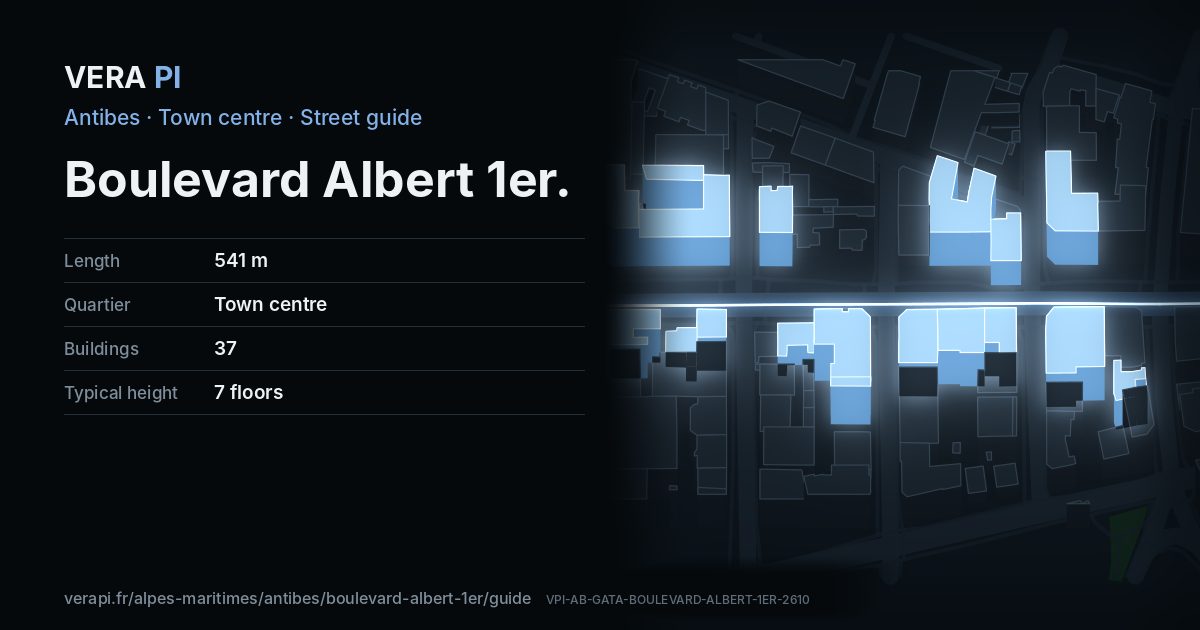
Every apartment building and landmark on Boulevard Albert 1er, drawn at its height from OpenStreetMap. Walk it with the slider, switch sides, or tap a building for its card.
Skip the mapSwipe along the street
The buildings on Boulevard Albert 1erPublic buildings and landmarksOther buildingsHeights from OpenStreetMap
Everything along the street
Building by building
37 buildings with their own page on Boulevard Albert 1er. Tap one to see it on the map.
Odd numbers 17
- 1Apartment building5 floors
- 3Apartment buildingbuilt 1958 · 8 floors
- 3Le Monte Carlobuilt 1958 · 8 floors
- 3Apartment buildingbuilt 1958 · 8 floors
- 5Palais Macébuilt 1930 · 5 floors
- 7Le Suffrenbuilt 1960 · 7 floors
- 9Apartment buildingbuilt 1928 · 6 floors
- 9La Caravellebuilt 1928 · 5 floors
- 11 bisLe Grimaldibuilt 1929 · 7 floors
- 15Isadorabuilt 1981 · 8 floors
- 17Apartment buildingbuilt 1959 · 8 floors
- 17Le Gazanbuilt 1959 · 6 floors
- 19Apartment buildingbuilt 1967 · 7 floors
- 27-29Le Fabiolabuilt 1966 · 7 floors
- 31Apartment buildingbuilt 1930 · 5 floors
- 33Apartment buildingbuilt 1970 · 7 floors
- 43Apartment buildingbuilt 1971 · 6 floors
Even numbers 20
- 6Église Réformée de France
- 8-10Apartment buildingbuilt 1973 · 8 floors
- 12-14Apartment buildingbuilt 1964 · 7 floors
- 16Le Trianonbuilt 1957 · 7 floors
- 18Apartment buildingbuilt 1990 · 3 floors
- 20Reine Astridbuilt 1969 · 7 floors
- 24Apartment buildingbuilt 1925 · 4 floors
- 26Apartment buildingbuilt 2004 · 8 floors
- 26Apartment buildingbuilt 2004 · 7 floors
- 26Apartment buildingbuilt 2004 · 8 floors
- 28Le Poseïdonbuilt 1988 · 7 floors
- 30Le Prince Albert7 floors
- 32Le Splendidbuilt 1965 · 7 floors
- 34-36Apartment buildingbuilt 2018 · 7 floors
- 38Apartment buildingbuilt 2004 · 6 floors
- 38Apartment buildingbuilt 2004 · 6 floors
- 42Le Saumur7 floors
- 44Apartment buildingbuilt 1928 · 7 floors
- 44Apartment buildingbuilt 1928 · 5 floors
- 46San Michaelbuilt 1990 · 7 floors
Notable buildings and places
 Place du Général-de-GaulleBuilding · Town centreAlkhimov Maxim · CC BY 3.0 · Wikimedia Commons
 Temple protestant d'AntibesBuilding · Town centreAimelaime at French Wikipedia · Public domain · Wikimedia CommonsAlbert 1erStatue and art · La Salis & Le PonteilÀ Charles de GaulleBuilding · Town centreÉglise Réformée de FrancePlace of worship · 6 Boulevard Albert 1er
Getting around
- BusGuillabert
- BusMaizière
- BusPlace de Gaulle
- BusAvenue Maréchal Reille
- BusPlace Barnaud
- BusMaizière
Stops within 250 m of the street. Compagnie des Autobus d’Antibes, timetable valid 5 October – 18 December 2026 (Licence Ouverte 2.0).
Schools nearby
- ·École primaire Le PonteilSchool
- ·École maternelle Le PonteilSchool
- ·Collège des Frères RoustanSchool
- ·Groupe scolaire le PonteilSchool
- ·École primaire GuynemerSchool
- ·Collège FersenSchool
Within 400 m; OpenStreetMap.
Sources
- Buildings, heights, streets and places: © OpenStreetMap contributors, ODbL 1.0.
- Sights: Wikidata (CC0) and Wikipedia (CC BY-SA 4.0); photographs from Wikimedia Commons under the licence shown on each.
- Buses: Compagnie des Autobus d’Antibes GTFS, via transport.data.gouv.fr (Licence Ouverte 2.0).
- Sun: VERA PI’s model with the Copernicus GLO-30 terrain (© DLR e.V. 2010-2014 and © Airbus Defence and Space GmbH 2014-2018, provided under COPERNICUS by the European Union and ESA).
A VERA PI street guide – the same model as Strandvägen, Stockholm, fed with the open data of Antibes and France. Built 25 October 2026.