Walk the street
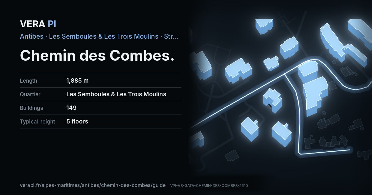
Every apartment building and landmark on Chemin des Combes, drawn at its height from OpenStreetMap. Walk it with the slider, switch sides, or tap a building for its card.
Skip the mapSwipe along the street
The buildings on Chemin des CombesPublic buildings and landmarksOther buildingsHeights from OpenStreetMap
Everything along the street
Building by building
149 buildings with their own page on Chemin des Combes. Tap one to see it on the map.
Odd numbers 66
- 215Apartment buildingbuilt 2001 · 5 floors
- 215Apartment buildingbuilt 2001 · 5 floors
- 215Apartment buildingbuilt 2001 · 5 floors
- 215Apartment buildingbuilt 2001 · 5 floors
- 215Apartment buildingbuilt 2001 · 5 floors
- 311Apartment buildingbuilt 1987 · 5 floors
- 311Apartment buildingbuilt 1987 · 5 floors
- 311Apartment buildingbuilt 1987 · 5 floors
- 311Apartment buildingbuilt 1987 · 5 floors
- 311Apartment buildingbuilt 1987 · 5 floors
- 311Apartment buildingbuilt 1987 · 5 floors
- 439Apartment buildingbuilt 2000 · 5 floors
- 439Apartment buildingbuilt 2000 · 5 floors
- 439Apartment buildingbuilt 2000 · 5 floors
- 439Apartment buildingbuilt 2000 · 5 floors
- 439Apartment buildingbuilt 2000 · 5 floors
- 439Apartment buildingbuilt 2000 · 5 floors
- 439Apartment buildingbuilt 2000 · 5 floors
- 509Apartment buildingbuilt 1969 · 5 floors
- 571Apartment buildingbuilt 1999 · 5 floors
- 519Apartment buildingbuilt 1966 · 2 floors
- 519Apartment buildingbuilt 1991 · 2 floors
- 519Apartment buildingbuilt 1966 · 2 floors
- 571Apartment buildingbuilt 2002 · 2 floors
- 655Apartment buildingbuilt 1974 · 4 floors
- 571Apartment buildingbuilt 1999 · 5 floors
- 655Apartment buildingbuilt 1974 · 4 floors
- 655Apartment buildingbuilt 1974 · 4 floors
- 739Apartment buildingbuilt 1991 · 5 floors
- 655Apartment buildingbuilt 1974 · 4 floors
- 739Apartment buildingbuilt 1991 · 5 floors
- 739Apartment buildingbuilt 1991 · 5 floors
- 739Apartment buildingbuilt 1991 · 5 floors
- 739Apartment buildingbuilt 1991 · 5 floors
- 739Apartment buildingbuilt 1991 · 5 floors
- 739Apartment buildingbuilt 1991 · 5 floors
- 833Apartment buildingbuilt 1988 · 5 floors
- 739Apartment buildingbuilt 1991 · 4 floors
- 833Apartment buildingbuilt 1988 · 5 floors
- 739Apartment buildingbuilt 1991 · 5 floors
- 793bis-797Apartment building1 floors
- 793Apartment building1 floors
- 833Apartment buildingbuilt 1988 · 5 floors
- 793Apartment building1 floors
- 833Avenue des Eucalyptusbuilt 1988 · 5 floors
- 833Apartment buildingbuilt 1988 · 5 floors
- 911Apartment buildingbuilt 1957 · 4 floors
- 911Apartment buildingbuilt 1957 · 4 floors
- 911Apartment buildingbuilt 1957 · 4 floors
- 911Apartment buildingbuilt 1957 · 4 floors
- 911Apartment buildingbuilt 1957 · 4 floors
- 911Apartment buildingbuilt 1957 · 4 floors
- 911Apartment buildingbuilt 1957 · 4 floors
- 911Apartment buildingbuilt 1957 · 4 floors
- 961Apartment buildingbuilt 1989 · 5 floors
- 911Apartment buildingbuilt 1957 · 4 floors
- 961Apartment buildingbuilt 1989 · 5 floors
- 961Apartment buildingbuilt 1989 · 5 floors
- 961Apartment buildingbuilt 1989 · 5 floors
- 961Apartment buildingbuilt 1989 · 5 floors
- 1039Apartment buildingbuilt 2017 · 4 floors
- 1465-1484Le Bel Air - Abuilt 2012 · 5 floors
- 1465Le Bel Air - Bbuilt 2012 · 5 floors
- 1465Le Bel Air - Cbuilt 2012 · 5 floors
- 1465Le Bel Air - Dbuilt 2012 · 5 floors
- 1547France Travailbuilt 2019 · 1 floors
Even numbers 83
- 24Apartment buildingbuilt 1967 · 5 floors
- 120Apartment buildingbuilt 1967 · 11 floors
- 120Apartment buildingbuilt 1967 · 11 floors
- 120Apartment buildingbuilt 1967 · 11 floors
- 120Apartment buildingbuilt 1967 · 11 floors
- 120Apartment buildingbuilt 1967 · 11 floors
- 240Apartment buildingbuilt 2013 · 5 floors
- 240Apartment buildingbuilt 2013 · 5 floors
- 160Apartment buildingbuilt 1967 · 11 floors
- 240Apartment buildingbuilt 2013 · 5 floors
- 260Bâtiment Hbuilt 2008 · 4 floors
- 120Apartment buildingbuilt 1967 · 11 floors
- 240Apartment buildingbuilt 2013 · 5 floors
- 220Apartment buildingbuilt 2012 · 5 floors
- 260Bâtiment B'built 2008 · 4 floors
- 230Apartment buildingbuilt 2016 · 5 floors
- 260Bâtiment Bbuilt 2008 · 4 floors
- 230Apartment buildingbuilt 2016 · 5 floors
- 230Carré Designbuilt 2016 · 6 floors
- 230Apartment buildingbuilt 2016 · 5 floors
- 230Apartment buildingbuilt 2016 · 5 floors
- 230Apartment buildingbuilt 2016 · 5 floors
- 260Apartment buildingbuilt 2008 · 1 floors
- 260Apartment buildingbuilt 2008 · 5 floors
- 260Apartment buildingbuilt 2008 · 5 floors
- 260Apartment buildingbuilt 2008 · 5 floors
- 260Apartment buildingbuilt 2008 · 5 floors
- 260Apartment buildingbuilt 2008 · 5 floors
- 260Apartment buildingbuilt 2008 · 5 floors
- 260Apartment buildingbuilt 2008 · 5 floors
- 260Apartment buildingbuilt 2008 · 5 floors
- 260Apartment buildingbuilt 2008 · 5 floors
- 260Apartment buildingbuilt 2008 · 5 floors
- 260Apartment buildingbuilt 2008 · 5 floors
- 260Apartment buildingbuilt 2008 · 5 floors
- 260Apartment buildingbuilt 2008 · 5 floors
- 270Apartment buildingbuilt 2021 · 6 floors
- 378Apartment building5 floors
- 260Apartment buildingbuilt 2008 · 5 floors
- 260Apartment buildingbuilt 2008 · 5 floors
- 378Apartment building5 floors
- 260Apartment buildingbuilt 2008 · 5 floors
- 260Apartment buildingbuilt 2008 · 5 floors
- 306Apartment buildingbuilt 2012 · 1 floors
- 260Apartment buildingbuilt 2008 · 5 floors
- 306Apartment buildingbuilt 2012 · 1 floors
- 260Apartment buildingbuilt 2008 · 5 floors
- 260Apartment buildingbuilt 2008 · 5 floors
- 378Apartment building5 floors
- 378Apartment building5 floors
- 260Apartment buildingbuilt 2008 · 5 floors
- 450Apartment buildingbuilt 2023 · 5 floors
- 260Apartment buildingbuilt 2008 · 5 floors
- 260Apartment buildingbuilt 2008 · 5 floors
- 450Apartment buildingbuilt 2023 · 5 floors
- 260Apartment buildingbuilt 2008 · 5 floors
- 464Apartment buildingbuilt 2014 · 4 floors
- 700Apartment buildingbuilt 1985 · 5 floors
- 738Apartment buildingbuilt 1990 · 5 floors
- 738Apartment buildingbuilt 1990 · 5 floors
- 738Apartment buildingbuilt 1990 · 5 floors
- 738Apartment buildingbuilt 1990 · 5 floors
- 738Apartment buildingbuilt 1990 · 5 floors
- 738Apartment buildingbuilt 1990 · 5 floors
- 738Apartment buildingbuilt 1990 · 5 floors
- 738Apartment buildingbuilt 1990 · 5 floors
- 824Apartment buildingbuilt 2017 · 5 floors
- 808Apartment buildingbuilt 2017 · 5 floors
- 1010Schoolbuilt 1974 · 1 floors
- ·Nursery school1 floors
- 1010Nursery schoolbuilt 1974 · 1 floors
- 1010Apartment buildingbuilt 1974 · 2 floors
- 1010Apartment buildingbuilt 1974 · 2 floors
- 1060Apartment buildingbuilt 1932 · 2 floors
- 1060Apartment buildingbuilt 1932 · 2 floors
- 1060Apartment buildingbuilt 1932 · 2 floors
- 1060Apartment buildingbuilt 1932 · 2 floors
- 1160Apartment buildingbuilt 2021 · 7 floors
- 1160Apartment buildingbuilt 2021 · 7 floors
- 1200Apartment buildingbuilt 2016 · 7 floors
- 1244Apartment buildingbuilt 2021 · 5 floors
- 1244Apartment buildingbuilt 2021 · 6 floors
- 1522Apartment buildingbuilt 2002 · 2 floors
Notable buildings and places
Chapelle Saint-Claude d'AntibesChurch · Les Semboules & Les Trois MoulinsJardin Mélinée et Missak ManouchianPark · Les Semboules & Les Trois Moulins1010 Chemin des CombesNursery school · 1010 Chemin des Combes1010 Chemin des CombesSchool · 1010 Chemin des CombesFrance TravailGovernment building · 1547 Chemin des CombesNursery school on Chemin des CombesNursery school · Nursery school on Chemin des Combes
Getting around
- BusCorail
- BusBastides
- BusBastides
- BusAntilles
- BusAntilles
- BusÉcole Jean Moulin
Stops within 250 m of the street. Compagnie des Autobus d’Antibes, timetable valid 5 October – 18 December 2026 (Licence Ouverte 2.0).
Schools nearby
- ·Pimprenelle Et NicolasNursery school
- ·Collège Pierre BertoneSchool
- ·École Jean MoulinSchool
- ·Crèche des CombesNursery school
Within 400 m; OpenStreetMap.
Sources
- Buildings, heights, streets and places: © OpenStreetMap contributors, ODbL 1.0.
- Sights: Wikidata (CC0) and Wikipedia (CC BY-SA 4.0); photographs from Wikimedia Commons under the licence shown on each.
- Buses: Compagnie des Autobus d’Antibes GTFS, via transport.data.gouv.fr (Licence Ouverte 2.0).
- Sun: VERA PI’s model with the Copernicus GLO-30 terrain (© DLR e.V. 2010-2014 and © Airbus Defence and Space GmbH 2014-2018, provided under COPERNICUS by the European Union and ESA).
A VERA PI street guide – the same model as Strandvägen, Stockholm, fed with the open data of Antibes and France. Built 25 October 2026.