Walk the street
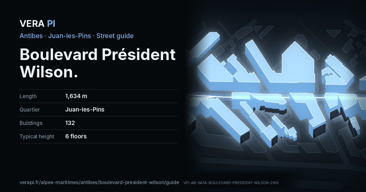
Every apartment building and landmark on Boulevard Président Wilson, drawn at its height from OpenStreetMap. Walk it with the slider, switch sides, or tap a building for its card.
Skip the mapEverything along the street
Building by building
132 buildings with their own page on Boulevard Président Wilson. Tap one to see it on the map.
Odd numbers 60
- 1Apartment buildingbuilt 1958 · 7 floors
- 7Apartment buildingbuilt 2017 · 6 floors
- 9Apartment buildingbuilt 1933 · 4 floors
- 9Le Varesebuilt 1912 · 4 floors
- 11-13Le Richelieubuilt 1957 · 8 floors
- 11Apartment buildingbuilt 1957 · 9 floors
- 29-31Bel-Airbuilt 1976 · 7 floors
- 33Forum Wilsonbuilt 1974 · 7 floors
- 35L'Oasisbuilt 1990 · 6 floors
- 35Apartment buildingbuilt 1990 · 7 floors
- 39Le Voltairebuilt 1974 · 8 floors
- 45Les Jardinièresbuilt 1930 · 4 floors
- 43Apartment buildingbuilt 1956 · 2 floors
- 47Zenithbuilt 2021 · 5 floors
- 49Le Colbertbuilt 1963 · 7 floors
- 51Le Marinabuilt 1962 · 7 floors
- 53Apartment buildingbuilt 1971 · 5 floors
- 53 bisOsirisbuilt 1983 · 8 floors
- 55-57Le Vegabuilt 1974 · 8 floors
- 59Le Quebecbuilt 1965 · 8 floors
- 59Le Montréalbuilt 1965 · 6 floors
- 63Lycée Audiberti
- 67-69Le Vendômebuilt 1967 · 6 floors
- 71Apartment buildingbuilt 1962 · 7 floors
- 71Les Cedresbuilt 1962 · 7 floors
- 73-77Le Tanitbuilt 1963 · 7 floors
- 81Apartment buildingbuilt 2007 · 4 floors
- 79Le Paeoniabuilt 1956 · 6 floors
- 81Apartment buildingbuilt 2007 · 4 floors
- 83La Brigantinebuilt 2007 · 7 floors
- 87La Pinèdebuilt 2020 · 7 floors
- 89Apartment buildingbuilt 2009 · 6 floors
- 89Apartment buildingbuilt 2009 · 6 floors
- 89Apartment buildingbuilt 2009 · 6 floors
- 89Apartment buildingbuilt 2009 · 6 floors
- 89-91Eden Bluebuilt 2009 · 7 floors
- 89Apartment buildingbuilt 2009 · 6 floors
- 89Apartment buildingbuilt 2009 · 6 floors
- 89Apartment buildingbuilt 2009 · 6 floors
- 93Apartment buildingbuilt 1989 · 7 floors
- 93Apartment buildingbuilt 1989 · 7 floors
- 93Apartment buildingbuilt 1989 · 7 floors
- 97L'Impérialbuilt 1989 · 7 floors
- 99-101Santa Febuilt 1967 · 7 floors
- 103Apartment buildingbuilt 1966 · 4 floors
- 103Apartment buildingbuilt 1966 · 4 floors
- 105-118Les Puits aux Féesbuilt 1963 · 7 floors
- 103Apartment buildingbuilt 1966 · 4 floors
- 103Apartment buildingbuilt 1966 · 4 floors
- 103Apartment buildingbuilt 1967 · 7 floors
- 103Apartment buildingbuilt 1966 · 4 floors
- 103Apartment buildingbuilt 1966 · 4 floors
- 103Apartment buildingbuilt 1966 · 4 floors
- 103-105Apartment buildingbuilt 1890 · 2 floors
- 103Apartment buildingbuilt 1966 · 4 floors
- 105Apartment buildingbuilt 1890 · 2 floors
- 113Apartment buildingbuilt 2022 · 6 floors
- 113-115Le Regencybuilt 2022 · 5 floors
- 117-121L'Iliadebuilt 1973 · 9 floors
- 131Apartment buildingbuilt 1932 · 5 floors
Even numbers 72
- 2Apartment buildingbuilt 1902 · 5 floors
- 8Apartment buildingbuilt 1971 · 7 floors
- 10-12 bisApartment buildingbuilt 1930 · 2 floors
- 12 bisL'Aiglonbuilt 1987 · 7 floors
- 14-18Le Marlybuilt 1966 · 6 floors
- 18Apartment buildingbuilt 1934 · 3 floors
- 18Apartment buildingbuilt 1934 · 3 floors
- 20-24Le Rossinibuilt 1965 · 7 floors
- 30-31Le Palais Antiboisbuilt 1958 · 6 floors
- 30 bisLa Pléïadebuilt 2006 · 7 floors
- 32Miradorbuilt 1959 · 7 floors
- 34Apartment buildingbuilt 1958 · 5 floors
- 34Le Deceatumbuilt 1958 · 5 floors
- 36Valdoria8 floors
- ·Apartment building7 floors
- 38Apartment buildingbuilt 1971 · 7 floors
- 40Apartment buildingbuilt 1970 · 4 floors
- 40-46Apartment buildingbuilt 1970 · 4 floors
- 58Apartment buildingbuilt 1926 · 3 floors
- 60Apartment buildingbuilt 1970 · 3 floors
- 62Le Santa Cruzbuilt 1971 · 7 floors
- 62 bisAryanabuilt 1980 · 7 floors
- 64Le Crystalbuilt 1989 · 8 floors
- 66Le Balzacbuilt 1965 · 7 floors
- 68Le Cezannebuilt 1966 · 6 floors
- 72Le Sylvanabuilt 1975 · 8 floors
- 74-76Le Katmandoubuilt 1980 · 7 floors
- 78Apartment buildingbuilt 1977 · 7 floors
- 78Apartment buildingbuilt 1977 · 6 floors
- 80Apartment building7 floors
- 80Apartment building5 floors
- 80Apartment building7 floors
- 80Apartment building7 floors
- 80Apartment building4 floors
- 82Les Mimosasbuilt 1970 · 7 floors
- 80Apartment building5 floors
- 80Apartment building7 floors
- 80Apartment building7 floors
- 84Apartment buildingbuilt 1930 · 2 floors
- 84Apartment buildingbuilt 1930 · 2 floors
- 84Apartment buildingbuilt 1930 · 2 floors
- 84Apartment buildingbuilt 1930 · 2 floors
- 84-88Le Reginabuilt 1967 · 8 floors
- 86Apartment buildingbuilt 1967 · 8 floors
- 90Estérel Wilsonbuilt 1964 · 8 floors
- 92Les Tritonsbuilt 1967 · 8 floors
- 94Apartment building4 floors
- 94Apartment building4 floors
- 94Apartment buildingbuilt 1967 · 8 floors
- 96Sun Beachbuilt 2022 · 7 floors
- ·Apartment building7 floors
- 98Apartment building5 floors
- 100Apartment building5 floors
- 98bisApartment buildingbuilt 1909 · 3 floors
- 100Apartment building5 floors
- 104New Californiabuilt 1998 · 6 floors
- 106New Californiabuilt 1998 · 6 floors
- 108New Californiabuilt 1998 · 6 floors
- 110Les Néréidesbuilt 2007 · 8 floors
- 112Apartment buildingbuilt 1961 · 4 floors
- 112Le Printempsbuilt 1961 · 6 floors
- 114Palais Jean Mauricebuilt 1956 · 5 floors
- 120Palais Wilsonbuilt 1930 · 6 floors
- 120Apartment buildingbuilt 1930 · 6 floors
- 122-124Wilson Palacebuilt 1963 · 7 floors
- 122Apartment buildingbuilt 1963 · 7 floors
- 128Apartment building3 floors
- 130Apartment buildingbuilt 1927 · 2 floors
- 136Apartment buildingbuilt 2002 · 8 floors
- 138Apartment buildingbuilt 1970 · 8 floors
- 138Le Bristolbuilt 1970 · 8 floors
- 140Résidence des Îlesbuilt 2010 · 5 floors
 Place du Général-de-GaulleBuilding · Town centre
Getting around
- BusPin Doré
- BusDames Blanches
- BusWilson
- BusWilson
- BusLycée Audiberti
- BusBalzac
Stops within 250 m of the street. Compagnie des Autobus d’Antibes, timetable valid 5 October – 18 December 2026 (Licence Ouverte 2.0).
Schools nearby
- ·École maternelle PeynetSchool
- ·École primaire Guillaume MussoSchool
- ·École primaire Le PonteilSchool
- ·École maternelle Le PonteilSchool
- ·Collège privé Saint-Philippe NériSchool
- ·École élémentaire privée Saint-Philippe NeriSchool
- ·Collège des Frères RoustanSchool
- ·Groupe scolaire le PonteilSchool
Within 400 m; OpenStreetMap.
Streets that meet it
Boulevard du Maréchal Foch Avenue Gaston Bourgeois Passage Marie-Antoinette Rue du Printemps Passage Wilson Boulevard Édouard Baudoin Avenue Docteur Fabre Avenue des Dames Blanches Avenue des Palmiers Boulevard Baptistin Ardisson Avenue Guy de Maupassant Traverse Martelly Rue de l'Hôtel des Postes Avenue Docteur Dautheville Avenue Maréchal de Lattre de Tassigny Rue des Lits Militaires Allée des Pins Dorés Chemin de Tanit Allée Eugénie Venet Avenue des Frères Olivier Avenue Georges Gallice Avenue de Provence Place Général de Gaulle Impasse Juan
Sources
- Buildings, heights, streets and places: © OpenStreetMap contributors, ODbL 1.0.
- Sights: Wikidata (CC0) and Wikipedia (CC BY-SA 4.0); photographs from Wikimedia Commons under the licence shown on each.
- Buses: Compagnie des Autobus d’Antibes GTFS, via transport.data.gouv.fr (Licence Ouverte 2.0).
- Sun: VERA PI’s model with the Copernicus GLO-30 terrain (© DLR e.V. 2010-2014 and © Airbus Defence and Space GmbH 2014-2018, provided under COPERNICUS by the European Union and ESA).
A VERA PI street guide – the same model as Strandvägen, Stockholm, fed with the open data of Antibes and France. Built 25 October 2026.