About Promenade de l'Amiral de Grasse
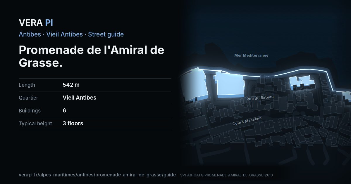
The sea wall of the old town, and the one stretch of Vauban’s walls still standing. It runs from the Château Grimaldi to the Bastion Saint-André, past the house where Nicolas de Staël painted more than 350 works between September 1954 and March 1955, with the Baie des Anges and the Alps across the water.
Text: Metro Mode, from Office de Tourisme – Antibes step by step; Wikipédia – Antibes (Prémices de changements).
Walk the street
Every apartment building and landmark on Promenade de l'Amiral de Grasse, drawn at its height from OpenStreetMap. Walk it with the slider, switch sides, or tap a building for its card.
Skip the mapEverything along the street
Building by building
6 buildings with their own page on Promenade de l'Amiral de Grasse. Tap one to see it on the map.
Notable buildings and places
 Musée PicassoThe Château Grimaldi stands where the acropolis of Greek Antipolis stood, above the sea wall.Original uploader was Olivier2000 at fr.wikipedia · CC BY-SA 1.0 · Wikimedia Commons
 Antibes Cathedral (Notre-Dame-de-l’Immaculée-Conception)Antibes was a bishopric from the fifth century until 1244, and its former cathedral – also called Notre-Dame-de-la-Platea – is still the largest church in town.Olivier2000 · CC BY-SA 1.0 · Wikimedia CommonsTour Grimaldi (the Saracen tower)The square tower beside the cathedral – the «Saracen tower» of the old town’s walks – is listed with the church and the Chapelle Saint-Esprit as one historic monument.Château des GrimaldiPalace · Vieil Antibes
 Chapelle Saint-Esprit d'AntibesChurch · Vieil AntibesAbxbay · CC BY-SA 4.0 · Wikimedia CommonsCathédrale Notre-Dame-de-la-Platea, chapelle Saint-Esprit et tour GrimaldiChurch · Vieil Antibes
 Place Jacques AudibertiBuilding · Vieil AntibesAbxbay · CC BY-SA 4.0 · Wikimedia CommonsThéâtre d'AntibesChurch · Vieil Antibes
Getting around
- BusAvenue Barquier
- BusAvenue Maréchal Reille
- BusMaizière
Stops within 250 m of the street. Compagnie des Autobus d’Antibes, timetable valid 5 October – 18 December 2026 (Licence Ouverte 2.0).
Schools nearby
- ·Collège FersenSchool
- ·École primaire privée Sainte-MarieSchool
Within 400 m; OpenStreetMap.
Sources
- Buildings, heights, streets and places: © OpenStreetMap contributors, ODbL 1.0.
- Sights: Wikidata (CC0) and Wikipedia (CC BY-SA 4.0); photographs from Wikimedia Commons under the licence shown on each.
- Buses: Compagnie des Autobus d’Antibes GTFS, via transport.data.gouv.fr (Licence Ouverte 2.0).
- Sun: VERA PI’s model with the Copernicus GLO-30 terrain (© DLR e.V. 2010-2014 and © Airbus Defence and Space GmbH 2014-2018, provided under COPERNICUS by the European Union and ESA).
A VERA PI street guide – the same model as Strandvägen, Stockholm, fed with the open data of Antibes and France. Built 25 October 2026.