The guide · by Metro Mode
Saint-Jean-Cap-Ferrat
A Y-shaped peninsula of gardens between the Rade de Villefranche and Beaulieu
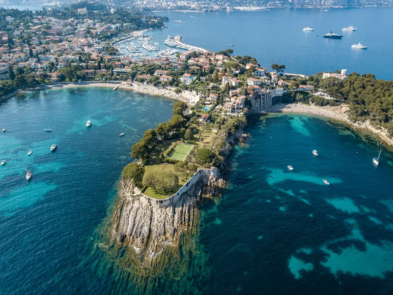
Cap Ferrat is a peninsula shaped like a Y between Villefranche and Beaulieu, reached from Pont Saint-Jean on the Basse Corniche. One branch is almost the whole cape, with its lighthouse at the southern tip; the other, narrower, runs east to the Pointe Saint-Hospice. Its name is usually traced to the Latin ferus, wild – the cape was scrub until its residents planted it, and it is now an arboretum of species brought from all over the world.
In the sixth century the hermit Hospice lived in a tower on the eastern point; Emmanuel-Philibert of Savoy fortified it, and Louis XIV's armies destroyed the fort in 1706. Saint-Jean was a hamlet of Villefranche, a few fishermen's houses round the church and the port, until it became a commune in its own right in 1904.
Read on
The Belle Époque made it: Leopold II of Belgium bought the Villa Les Cèdres in 1904, the Grand-Hôtel opened on the point in 1908, and Béatrice Ephrussi de Rothschild built her pink palace on the isthmus between 1905 and 1912. The coastal path runs right round the peninsula.
Highlights
- MuseumVilla Ephrussi de RothschildBéatrice Ephrussi de Rothschild's palace and gardens, 1905–1912
- Restaurant · One MICHELIN starLe CapThe Grand-Hôtel's gastronomic restaurant – one MICHELIN star in 2026
- Listed buildingPhare du Cap FerratThe lighthouse at the southern tip, rebuilt 1949–52 after 1944
- Listed buildingVilla Santo SospirThe villa whose walls Jean Cocteau «tattooed» from 1950 – visits by reservation
- HotelGrand Hôtel du Cap FerratThe palace hotel of 1908 at the tip of the cape, with its restaurant Le Cap
Five-star hotels
- Grand-Hôtel du Cap-Ferrat, A Four Seasons HotelPalace · 74 rooms
- Hôtel Royal Riviera94 rooms
Lists & itineraries
Everything, by kind
Sources
- Wikipédia (fr) : Saint-Jean-Cap-Ferrat
- Wikipedia (en): Saint-Jean-Cap-Ferrat
- Wikipédia (fr) : Grand-Hôtel du Cap-Ferrat
- Wikipédia (fr) : Villa Ephrussi de Rothschild
- Wikipédia (fr) : Sentier littoral
- OpenStreetMap contributors (ODbL)
- Wikidata
- INSEE IRIS / IGN (Licence Ouverte 2.0)